Mapeando seus dados
Introdução ao Tableau

Sara Billen
Curriculum Manager at DataCamp
O que são dados geográficos?
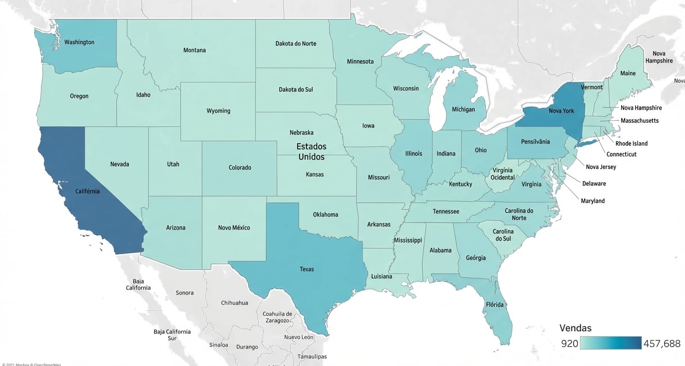
Mapa preenchido
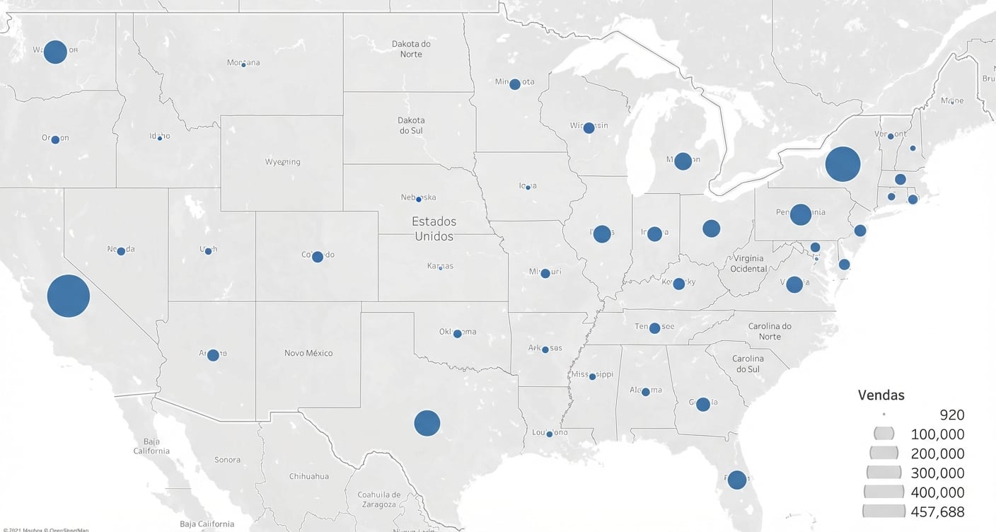
Mapas de símbolos
Tipos geográficos reconhecidos
- Geocodificação
- Ícone de globo

1 https://help.tableau.com/current/pro/desktop/en-us/maps_geographicroles.htm
Dados
![]()

