Koordinat Referans Sistemleri

Python ile Coğrafi Verilerle Çalışma

Joris Van den Bossche

Open source software developer and teacher, GeoPandas maintainer

Koordinat Referans Sistemi (CRS)

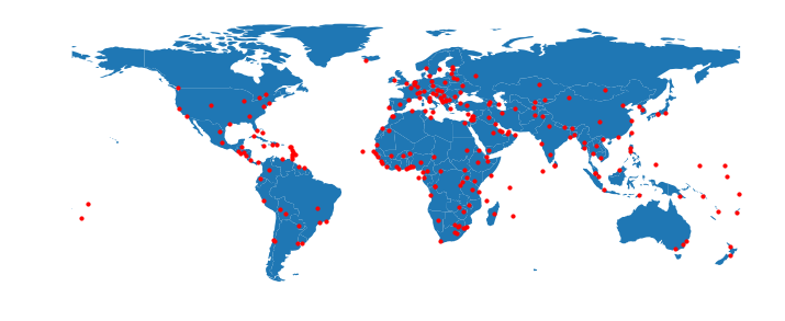
Eyfel Kulesi'nin konumu:

POINT (2.2945 48.8584)

→ Koordinat Referans Sistemi (CRS), koordinatları yeryüzündeki belirli bir konuma bağlar.

Python ile Coğrafi Verilerle Çalışma

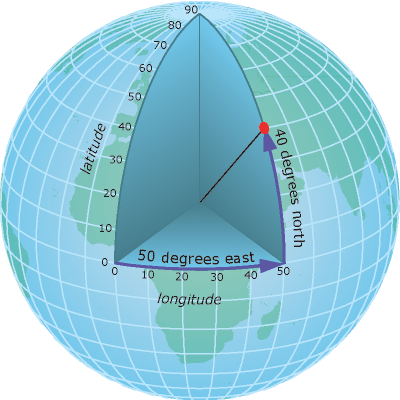
Coğrafi koordinatlar

Enlem ve boylam dereceleri.

Örn. 48°51′K, 2°17′D

GPS ve web haritalamada kullanılır...

Dikkat!
Python'da (lat, long) değil, (lon, lat) kullanılır

  • Boylam: [-180, 180]
  • Enlem: [-90, 90]
Python ile Coğrafi Verilerle Çalışma

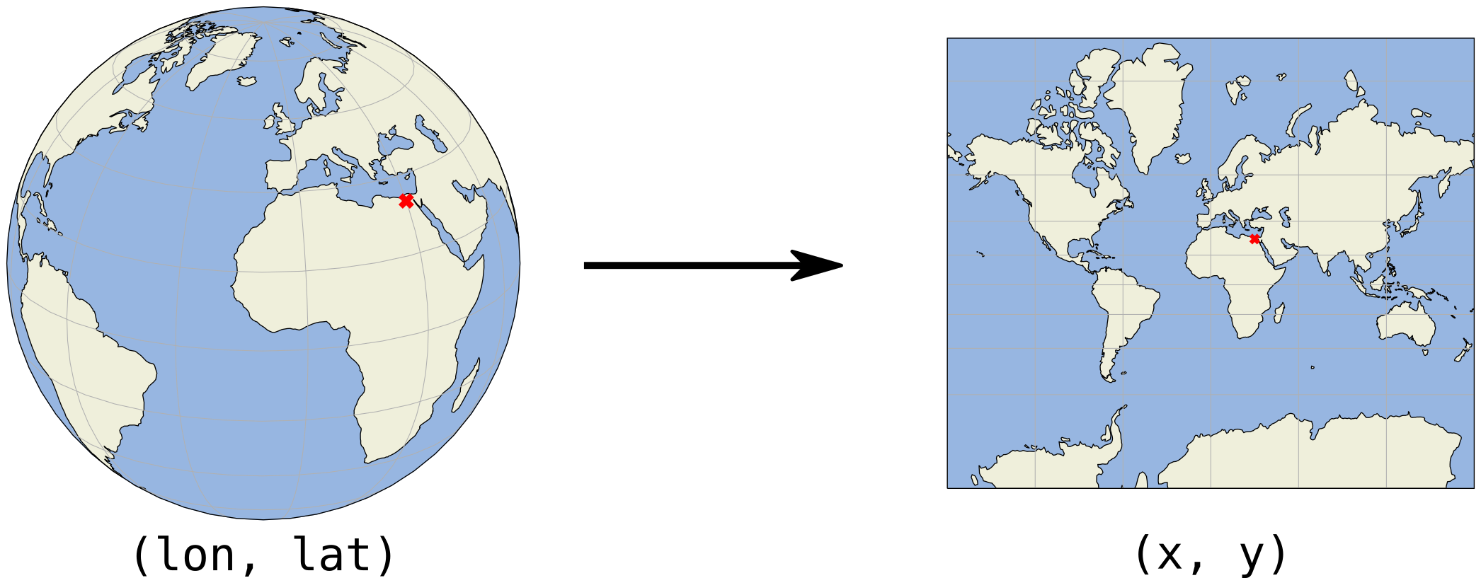
Haritalar 2B'dir

Python ile Coğrafi Verilerle Çalışma

Projeksiyonlu koordinatlar

(x, y) koordinatları genellikle metre veya fit cinsindedir

Python ile Coğrafi Verilerle Çalışma

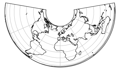
Projeksiyonlu koordinatlar - Örnekler

Albers Eş Alan projeksiyonu
Python ile Coğrafi Verilerle Çalışma

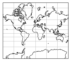
Projeksiyonlu koordinatlar - Örnekler

Mercator projeksiyonu
Python ile Coğrafi Verilerle Çalışma

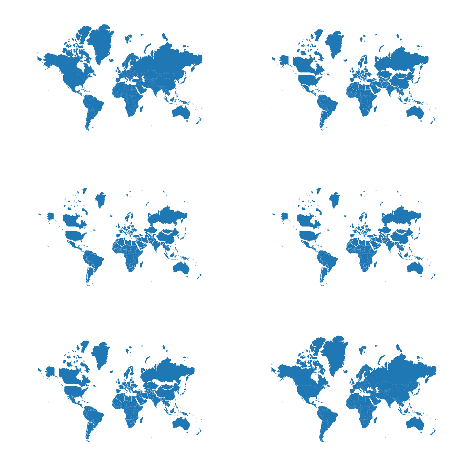
Projeksiyonlu koordinatlar - Örnekler

Projeksiyonlu boyut vs gerçek boyut (Mercator)
Python ile Coğrafi Verilerle Çalışma

Bir CRS belirtme

proj4 dizesi

Örnek: +proj=longlat +datum=WGS84 +no_defs

Sözlük gösterimi:

{'proj': 'longlat', 'datum': 'WGS84', 'no_defs': True}

EPSG kodu

Örnek:

EPSG:4326 = WGS84 coğrafi CRS (boylam, enlem)

Python ile Coğrafi Verilerle Çalışma

GeoPandas'ta CRS

.crs özniteliği (GeoDataFrame/GeoSeries):

import geopandas
gdf = geopandas.read_file("countries.shp")
print(gdf.crs)
{'init': 'epsg:4326'}
Python ile Coğrafi Verilerle Çalışma

Özet

  • "coğrafi" (long, lat) ve "projeksiyonlu" (x, y) koordinatlar
  • GeoPandas'ta Koordinat Referans Sistemi (CRS): .crs özniteliği
  • En yaygın coğrafi CRS: WGS84 veya EPSG:4326
Python ile Coğrafi Verilerle Çalışma

Hadi pratik yapalım

Python ile Coğrafi Verilerle Çalışma

Preparing Video For Download...