Lucrul cu date geospațiale în Python
Joris Van den Bossche
Open source software developer and teacher, GeoPandas maintainer

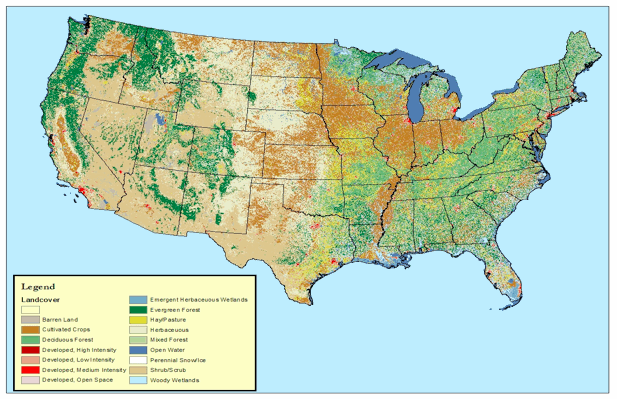
Sursă imagine: documentația QGIS


import rasterio
import rasterio
src = rasterio.open("DEM_world.tif")
Metadate:
src.count
1
src.width, src.height
(4320, 2160)
array = src.read()
Array numpy standard:
array
array([[[-4290, -4290, -4290, ..., -4290, -4290, -4290],
[-4278, -4278, -4278, ..., -4278, -4278, -4278],
[-4269, -4269, -4269, ..., -4269, -4269, -4269],
...,
[ 2804, 2804, 2804, ..., 2804, 2804, 2804],
[ 2804, 2804, 2804, ..., 2804, 2804, 2804],
[ 2804, 2804, 2804, ..., 2804, 2804, 2804]]], dtype=int16)
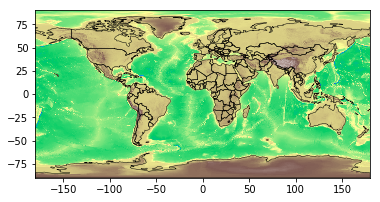
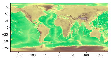
Utilizând metoda rasterio.plot.show():
import rasterio.plot
rasterio.plot.show(src, cmap='terrain')

rasterstats: Statistici rezumative ale seturilor de date raster geospaciale bazate pe geometrii vectoriale (https://github.com/perrygeo/python-rasterstats)
Pentru vectori de tip punct:
rasterstats.point_query(geometries, "path/to/raster",
interpolation='nearest'|'bilinear')
Pentru vectori de tip poligon:
rasterstats.zonal_stats(geometries, "path/to/raster",
stats=['min', 'mean', 'max'])
result = rasterstats.zonal_stats(countries.geometry, "DEM_gworld.tif", stats=['mean'])countries['mean_elevation'] = pd.DataFrame(result)countries.sort_values('mean_elevation', ascending=False).head()
name continent geometry mean_elevation
157 Tajikistan Asia POLYGON ((74.98 37.41, ... 3103.231105
85 Kyrgyzstan Asia POLYGON ((80.25 42.34, ... 2867.717142
24 Bhutan Asia POLYGON ((91.69 27.77, ... 2573.559846
119 Nepal Asia POLYGON ((81.11 30.18, ... 2408.907816
6 Antarctica Antarctica (POLYGON ((-59.57 -80.04... 2374.075028
.. ... ... ... ...
Lucrul cu date geospațiale în Python