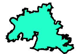
Python में Geospatial Data का Visualization
Mary van Valkenburg
Data Science Program Manager, Nashville Software School
# the geometry column is a GeoSeries
type(school_districts.geometry)
geopandas.geoseries.GeoSeries
GeoSeries.area - GeoSeries में हर geometry का area देता हैGeoSeries.centroid - GeoSeries में हर geometry का center point देता हैGeoSeries.distance(other) - other तक का minimum distance देता है# districts के पहले polygon का area
print(districts.geometry[0].area)
325.78

# school districts की पहली 4 पंक्तियाँ और कुल पंक्तियाँ प्रिंट करें
print(school_districts.head(4))
print('There are ', school_districts.shape[0], ' school districts.' )
first_name last_name position district geometry
Sharon Gentry Member 1 (POLYGON ((-86.771 36.383...)))
Jill Speering Vice-Chair 3 (POLYGON ((-86.753 36.404...)))
Jo Ann Brannon Member 2 (POLYGON ((-86.766 36.083...)))
Anna Shepherd Chair 4 (POLYGON ((-86.580 36.209...)))
There are 9 school districts.
# हर school district का area निकालें
district_area = school_districts.area
# areas और उपयोग किए गए crs प्रिंट करें
print(district_area.sort_values(ascending = False))
print(school_districts.crs)
0 0.036641
4 0.023030
8 0.015004
1 0.014205
3 0.014123
5 0.010704
2 0.008328
7 0.007813
6 0.006415
dtype: float64
epsg:4326
# school_districts की एक कॉपी बनाएँ जो EPSG:3857 उपयोग करती है school_districts_3857 = school_districts.to_crs(epsg = 3857)# m^2 से km^2 के लिए वैरिएबल परिभाषित करें और क्षेत्रफल km^2 में लें sqm_to_sqkm = 10**6 district_area_km = school_districts_3857.area / sqkm_to_sqm print(district_area_km.sort_values(ascending = False)) print(school_districts_3857.crs)
0 563.134380
4 353.232132
8 230.135653
1 218.369949
3 216.871511
5 164.137548
2 127.615396
7 119.742279
6 98.469632
dtype: float64
epsg:3857
Python में Geospatial Data का Visualization