प्रोजेक्शन और Coordinate Reference Systems

Python में Geospatial Data का Visualization

Mary van Valkenburg

Data Science Program Manager, Nashville Software School

प्रोजेक्शन
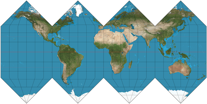
गोलाकार पृथ्वी का समतल मानचित्र

Python में Geospatial Data का Visualization

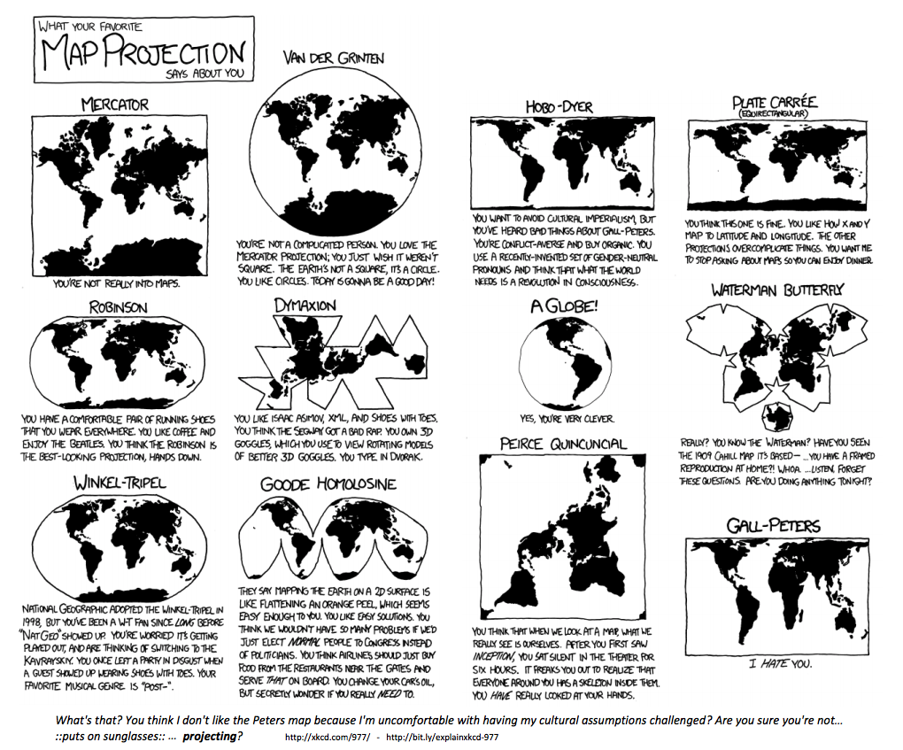
मैप प्रोजेक्शन के कई तरीके

मैप प्रोजेक्शन पर xkcd कॉमिक

Python में Geospatial Data का Visualization

Coordinate Reference Systems

EPSG:4326

  • Google Earth में उपयोग होता है
  • इकाइयाँ: decimal degrees

EPSG:3857

  • Google Maps, Bing Maps, OpenStreetMap में उपयोग होता है
  • इकाइयाँ: meters
Python में Geospatial Data का Visualization
School Name              Latitude     Longitude
A. Z. Kelley Elementary    36.021       -86.658
Alex Green Elementary      36.252       -86.832
Amqui Elementary           36.273       -86.703
Andrew Jackson Elementary  36.231       -86.623
import geopandas as gpd
schools['geometry'] = gpd.points_from_xy(schools.Longitude, schools.Latitude)
schools.head(4)
School Name                Latitude  Longitude                geometry
A. Z. Kelley Elementary      36.021    -86.658  POINT (-86.658 36.021)
Alex Green Elementary        36.252    -86.832  POINT (-86.832 36.252)
Amqui Elementary             36.273    -86.703  POINT (-86.703 36.273)
Andrew Jackson Elementary    36.231    -86.623  POINT (-86.623 36.231)
Python में Geospatial Data का Visualization

DataFrame से GeoDataFrame बनाना

import geopandas as gpd

schools_geo = gpd.GeoDataFrame(schools, 
                               crs = 'epsg:4326', 
                               geometry = schools.geometry)
schools_geo.head(4)
School Name                Latitude  Longitude               geometry
A. Z. Kelley Elementary      36.021    -86.658  POINT (-86.658 36.021)
Alex Green Elementary        36.252    -86.832  POINT (-86.832 36.252)
Amqui Elementary             36.273    -86.703  POINT (-86.703 36.273)
Andrew Jackson Elementary    36.231    -86.623  POINT (-86.623 36.231)
Python में Geospatial Data का Visualization

एक CRS से दूसरे में बदलना

schools_geo.head(2)
School Name              Latitude  Longitude                geometry
A. Z. Kelley Elementary    36.021    -86.658  POINT (-86.658 36.021)
Alex Green Elementary      36.252    -86.832  POINT (-86.832 36.252)
schools_geo.geometry = schools_geo.geometry.to_crs(epsg = 3857)
schools_geo.head(2)
School Name              Latitude  Longitude                      geometry
A. Z. Kelley Elementary    36.021    -86.658  POINT (-9646818.8 4303623.8)
Alex Green Elementary      36.252    -86.832  POINT (-9666119.5 4335484.4)
Python में Geospatial Data का Visualization

अभ्यास करते हैं!

Python में Geospatial Data का Visualization

Preparing Video For Download...