การทำงานกับ Folium

การแสดงผลข้อมูลเชิงภูมิศาสตร์ด้วย Python

Mary van Valkenburg

Data Science Program Manager, Nashville Software School
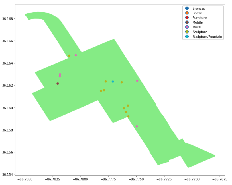
กราฟแผนที่รูปหลายเหลี่ยมสีเขียวอ่อนพร้อมจุดตำแหน่งงานศิลปะ

การแสดงผลข้อมูลเชิงภูมิศาสตร์ด้วย Python

Folium

  • แพ็กเกจ Python
  • แผนที่แบบอินเทอร์แอกทีฟ
  • สร้างบน Leaflet.js

โลโก้ใบไม้ของ Folium

การแสดงผลข้อมูลเชิงภูมิศาสตร์ด้วย Python

folium.Map()

import folium
# construct a map centered at the Eiffel Tower
eiffel_tower = folium.Map(location = [48.8583736,2.2922926])

# display the map
display(eiffel_tower)
การแสดงผลข้อมูลเชิงภูมิศาสตร์ด้วย Python

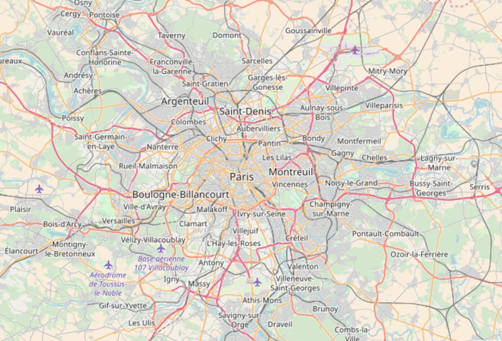
แผนที่ถนนของปารีส

การแสดงผลข้อมูลเชิงภูมิศาสตร์ด้วย Python

การกำหนดระดับการซูม

import folium
# construct a map centered at the Eiffel Tower
eiffel_tower = folium.Map([location = 48.8583736,2.2922926], zoom_start = 12)

# display the map
display(eiffel_tower)
การแสดงผลข้อมูลเชิงภูมิศาสตร์ด้วย Python

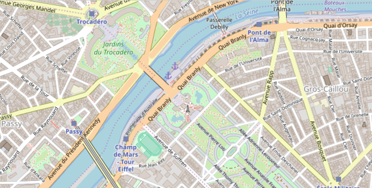
แผนที่ถนนของปารีสที่ซูมเข้าพร้อมหอไอเฟลขนาดเล็ก

การแสดงผลข้อมูลเชิงภูมิศาสตร์ด้วย Python

ตำแหน่ง Folium จากจุดเซนทรอยด์

district_one.head()
district  center                   geometry
1         POINT (-86.860 36.262)   (POLYGON ((-86.771 36.383...    
center_point = district_one.center[0]
type(center_point)
<class 'shapely.geometry.point.Point'>
การแสดงผลข้อมูลเชิงภูมิศาสตร์ด้วย Python

ตำแหน่ง Folium จากจุดเซนทรอยด์

# reverse the order for folium location array
district_center = [center_point.y, center_point.x]

# print center point and district_center
print(center_point)
print(district_center)
POINT (-86.86086595994405 36.2628221811899)
[36.262822181189904, -86.86086595994405]
การแสดงผลข้อมูลเชิงภูมิศาสตร์ด้วย Python

การเพิ่มรูปหลายเหลี่ยมลงในแผนที่ Folium

# create a folium map centered on district 1
district1_map = folium.Map(location = district_center)
# add the outline of district one
folium.GeoJson(district_one.geometry).add_to(district1_map)
# display the resulting map
display(district1_map)
การแสดงผลข้อมูลเชิงภูมิศาสตร์ด้วย Python

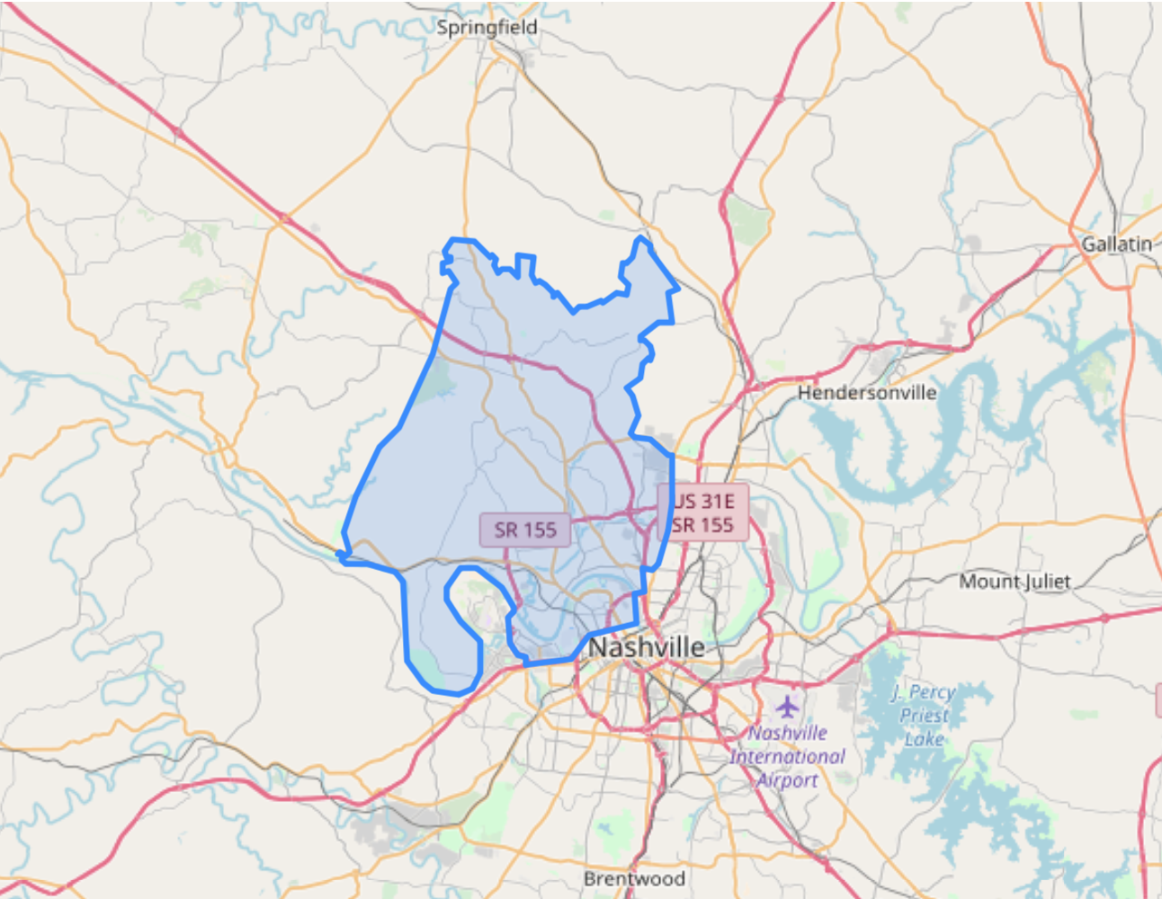
แผนที่พร้อมรูปหลายเหลี่ยมสีน้ำเงิน

การแสดงผลข้อมูลเชิงภูมิศาสตร์ด้วย Python

มาฝึกกันเถอะ!

การแสดงผลข้อมูลเชิงภูมิศาสตร์ด้วย Python

Preparing Video For Download...