Overlaying spatial datasets
Working with Geospatial Data in Python

Joris Van den Bossche
Open source software developer and teacher, GeoPandas maintainer
Intersection with a polygon
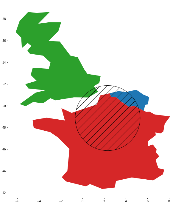
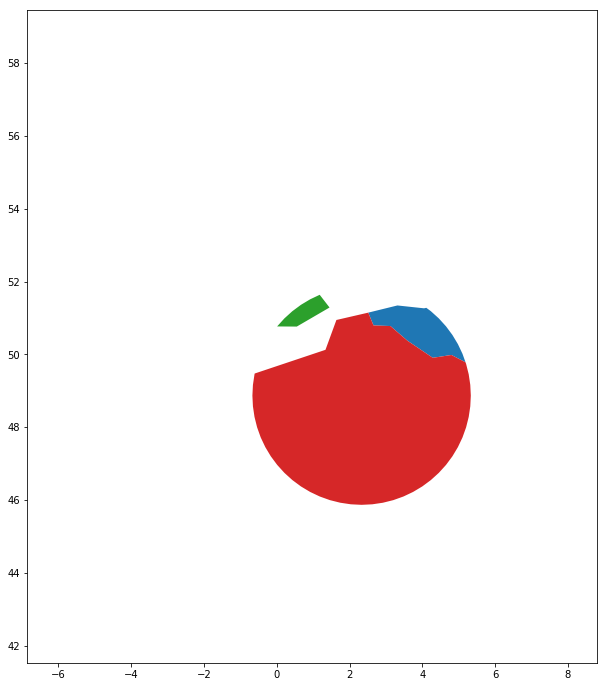
countries.intersection(circle)
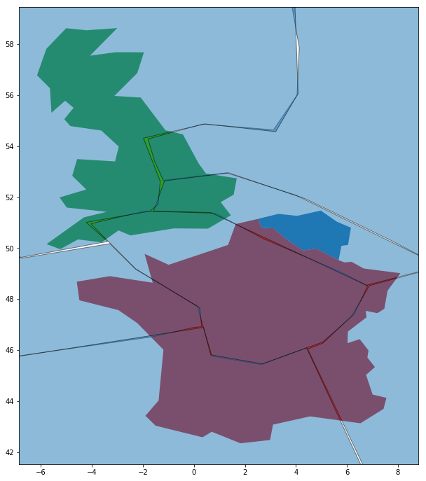
Overlaying two datasets
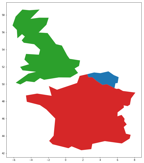
countries.plot()
geologic_regions.plot()
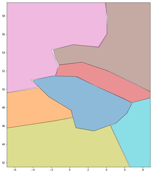
Overlaying two datasets
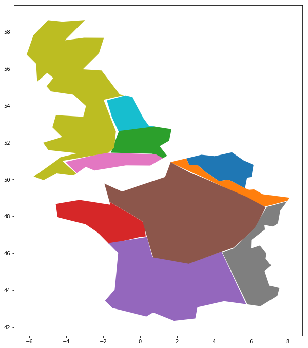
geopandas.overlay(countries, geologic_regions,
                  how='intersection')

